What is XPSWMM?
XPSWMM is a holistic 1D/2D modeling package for stormwater and wastewater problems. It helps engineers and watershed managers to simulate hydrology, hydraulics, water quality and surface flooding.
XPSWMM is a holistic 1D/2D modeling package for stormwater and wastewater problems. It helps engineers and watershed managers to simulate hydrology, hydraulics, water quality and surface flooding.
Tested around the world and meeting the requirements in the U.S. for NFIP submissions, XPSWMM is the solution chosen by hundreds of engineers, watershed managers, and modelers worldwide.

Integrated 1D and 2D capabilities allow you to model interaction between flood waters and drainage systems – giving you the complete picture of water flows for all urban and rural elements.
Customize output results to provide a full view of what happens, when, and where - giving engineers a complete understanding of risks and system performance.

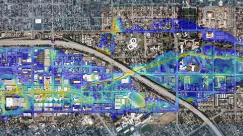
Run floodplain simulations for complete urban environments. XPSWMM allows integrated analysis of flow and pollutant transport in engineered and natural systems including ponds, rivers, lakes, and overland floodplains. You can confidently produce hazard maps and accurate floodplain maps resulting from your model.
Combine hydrology and hydraulics in the same model. XPSWMM simulates natural rainfall-runoff processes and the hydraulic performance of drainage systems used to manage water resources. Identify actions for pollutant removal, flood preparedness, and capacity analysis.
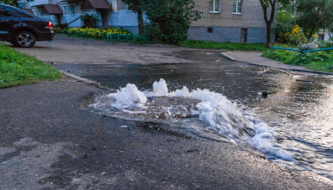
XPSWMM helps you keep ahead of Combined Sewer Overflows (CSOs) and Sanitary Sewer Overflow (SSOs). Keep track of Rainfall Derived Infiltration and Inflow (RDII). Use real-time controls (RTC) to evaluate operation management plans and practices that produce changing conditions in your model. This includes time-dependant and condition-controlled elements such as weirs and gates.
XPSWMM’s Solve Manager lets you run multiple simulations in parallel. You can compare various “What If?” scenarios graphically and in tables. Evaluate the model across a range of rainfall events and durations to identify the critical storm. Consider the performance of green infrastructure on stormwater control systems.
Generate complete Master Plans for stormwater systems, sanitary systems or watersheds to maintain an efficient Capacity Management and Operations Maintenance (CMOM) program.
Import GIS, CAD, HEC-RAS data and more so that you can construct models from various data sources in a single repository. Create or import land surfaces to allow generation of cross sections of open channels, assignment of 1D node elevations, or computation of overland flow depths.
Learn how technology helps ensure the impacts of urbanization and extreme weather do not put our environment or communities at risk
Learn how Jacobs Engineering created a Groundwater Infiltration Model (GIM) in InfoWorks ICM to calibrate the wet weather flows in Dekalb County’s collection system model.
Scottish Canals created a digital twin of the North Glasgow water network to build Europe’s first Smart Canal.
